

Information Sites for the region: : http://kouvela.blogspot.gr/
Region map : Google maps
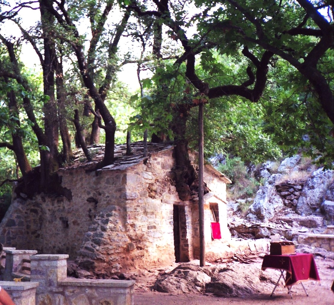
The river of Neda is the natural border of the prefectures of Ilia and Messinia. It is one of the two rivers of Greece with a female name (the other is Arapitsa in Naoussa). It starts from Lykaio mountain and its waters, after 32 km of natural beauty, flows into the Ionian Sea outside the village of Elaia, (22,8 km) near the town of Kyparissia. According to mythology, when Rhea gave birth to Zeus, she gave him to nymph Neda, a deity of water, to protect him from her husband Saturn. The nymph hides Zeus on Lykaio mountain. The archaeological sites in the region are also important. Close to Neda’s springs, is the Temple of Epicurean Apollo, which was built by Iktinos , as well as the Temple of Pan. At the top of Lykaio mountain , Zeus was worshiped. Nearby , there is also Lykosoura, which Hesiod considered “the first city of humanity”. Pausanias in the 2nd c. A.D. refers to the temple of Demeter on the banks of Neda. Between the villages of Vasta and Ano Melpeia is Aghia Theodora, the famous chapel with its 17 trees in its mantle.
To cross the gorge you have to be well prepared (food, shoes and swimwear) for 5 to 6 hours of hiking and swimming in some parts of the river. However, there are also individual routes, shorter in time, leading to points of interest.
Route from Ancient Figalia
The starting point of the route , the huge plane tree on the eastern edge of ancient Figalia. From the ancient fountain heading south, we reach in 500 meters on the edge of the gorge. From there a beautiful downhill path, with wooden stairs, leads to the waterfall “White Water” at the intersection of the tributary Lymax and Neda. From the wooden bridge, you can admire the view of the waters that fall from above (about 40m) between the lush vegetation. Aged plane trees and oak trees, create a magnificent and wonderful scenery of natural beauty.

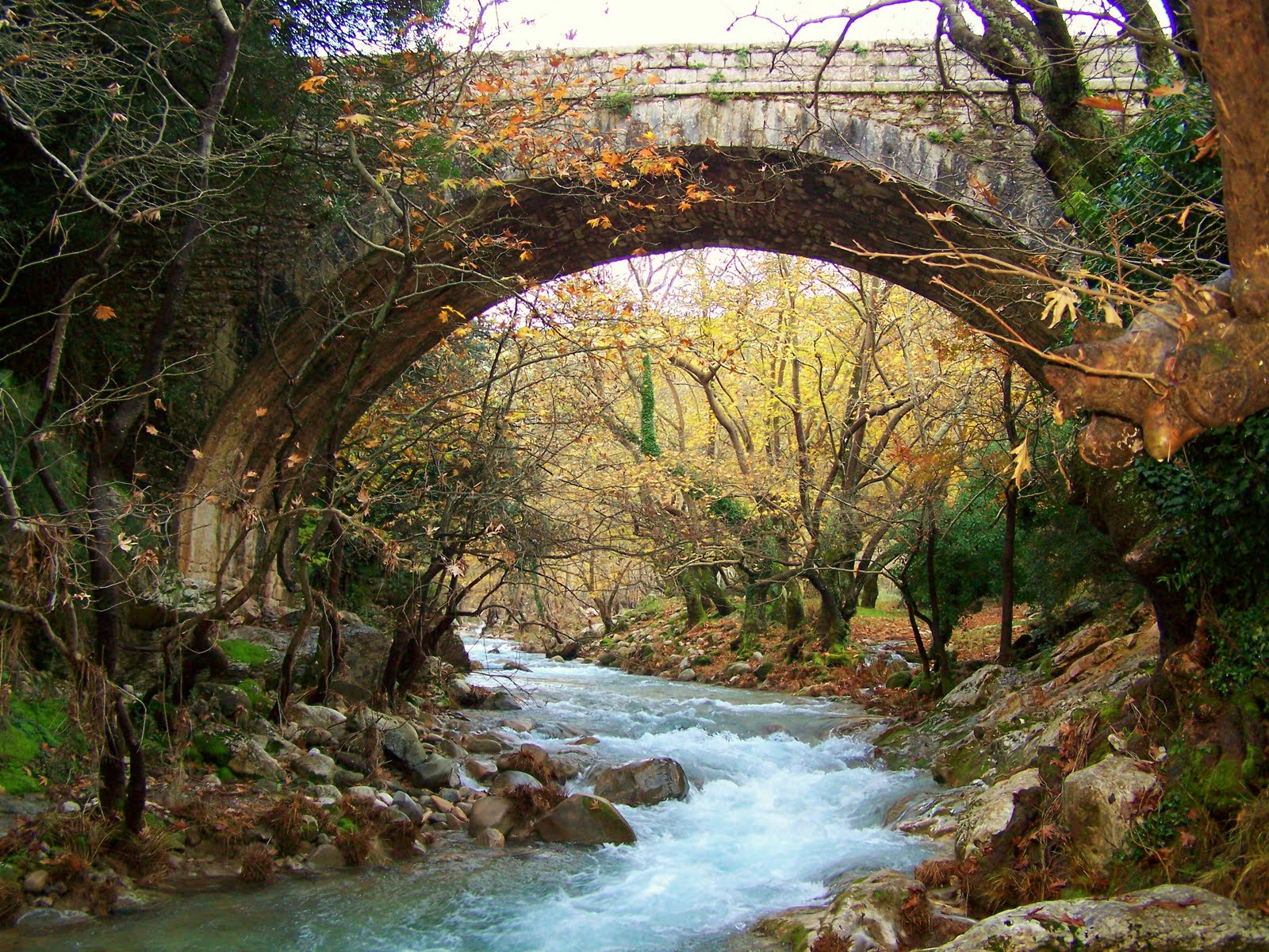
From the waterfall “White Water” if we continue, we can cross the gorge, following the flow of crystal and frozen waters. In about two hours, we meet the arched stone bridge that connects Ilia with Messinia.
From there, we continue on the riverbed or the formed path on the north bank and we reach “Stomio”, where the river is lost, buzzing in a tunnel-cave about 80 meters long. If we climb right to the rocks, we reach the waterfalls and we can visit the chapel of Panagia built at the root of the rock and swim in the cold waters of the lake of the great waterfall. If we continue straight, we enter the tunnel-cave and we must be prepared for a swim and a strong experience. The light is diminishing, at the other end we can see the exit and the openings on the cave’s roof, allow us to continue our journey in the dark. The cave is quite tall and the bats are nesting on its roof. The area of Stomio is the most impressive point of the gorge.

Once we get to the other end, we can either continue on the river root (its bed opens and ends between small waterfalls and ponds in the Ionian Sea) or we can go back from the path on the riverbank and climb smoothly to Ancient Figalia. The trail ends at the South West Gate of Ancient Figalia’s wall. Experiencing all the above, we must give credentials to the locals, because they have preserve and “upgrade” the natural beauty of the area by making marked paths, orientation maps, paved streets, etc.
Route from the village of Platania
The village of Platania is the closest point to the most interesting and most approachable point of the gorge. Arriving in Platania you will follow the steep downhill (even for non-4×4 vehicles) earth road that descend for 3 km up to the river bed. After crossing the bridge, turn left and follow the path to the heart of the gorge. After the first waterfall, the one with the wooden bridge, the path continues, and leads (after 20 min) by taking the right direction, to the large, impressive waterfall that you see in most Neda’s photos and by going straight ahead, to the church of Panagia. At this point we are just above the entrance of Stomio (see the route from Figalia). Again, you can, either continue to the sea or go back to the archaeological site of Ancient Figalia.
Route from the village of Kouvela
Beneath the village’s café, begins the road that goes to Petrogefiro. Pass the village of Mavromati and after a while you will come across a sign which points, to the right for Stichio and to the left to Petrogyfiro ( it is an earth road). Turn to Petrogefiro direction and after about 2 Km, you find a large space next to the river surrounded by plane trees, which is very convenient for camping. In a few meters more, you will see the stone bridge (of Kouvela). You start the descent (only in the summer, because the water level becomes too high for the rest of the year). On the route, you will find points that you must swim, but only for a few meters. After about 2.5 hours you will reach the bridge (see the route from Platania) and the best is yet to come. Slowly the dense trees will give their place to the rocks and the gorge will begin to get narrow. Until you reach Stomio you will see amazing pictures. From this point, you can continue, as it is described in the previous routes.
This hike is one of the best I have done and I highly recommend it.
Text: Constantine Tsakanikas, Thodoris Lambrou
Photos: Thodoris Lamprou, kouvela.blogspot.gr