(you can read it together with part I)
Koziakas refuge (1750m) – Chatzipetros summit(1901m)
Day 2
Route Information
Route Description: Trekking
Route Length: 1 km
Water in route: No
Duration: 45min
The route took place at OCT 2019
Team members 7 adults
Our evening was wonderful. Sitting on the refuge’s balcony, without being bothered by the evening chill (3 degrees Celsius) we were admiring the twilight and the night sky that was slowly began to be filled with stars. We had made arrangements with the refuge guys and they had bought pork chops for us. So since we all got together (remember, from the first part of the post, that our friends from Trikala arrived in the afternoon) the barbecue started. Pericles, the refuge manager was the chef and as it turned out, a very successful one.
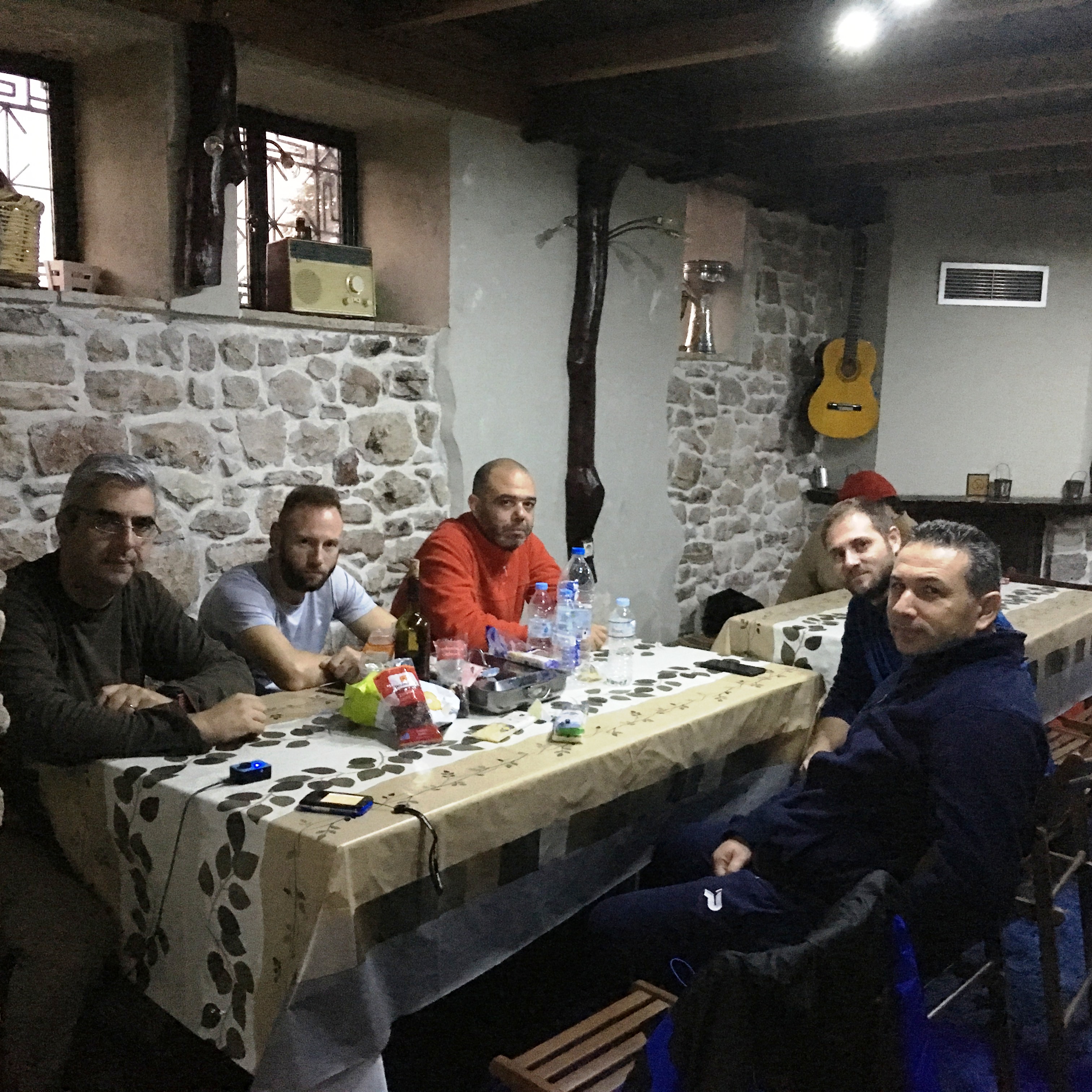
He served us a royal dinner, with barbecued steaks, Greek salad and wine, all from the region and the villages nearby. Our table chat was about climbing stories, jokes and suggestions for new routes. And after we had finished with all the mountaineering issues, we started the “songs”. We had a guitar player with us and a guitar was hanging on the wall. What a great opportunity to show off our singing skills. That was the lovely way that our evening ended and we retired to our beds since next day was the summit day.
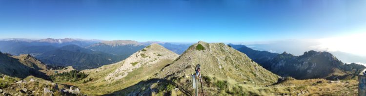
We all got up early with anticipation of the ascent in our thoughts. We get our morning coffee on the refuge’s terrace, gazing at the peaks that stand in front of us. Our goal is the left one. We are following the path with our eyes and the discussion is about the route and the last details of the climb. We begin our hike heading east, to the characteristic group of the last fir trees that in a way, are marking the alpine zone.

We are now at the foot of the granite mass of the peaks, below the right peak. We are crossing the fir trees and we turn left traversing the slope, slowly gaining altitude, up to the mountain pass in our left hand. Now the path is marked with yellow signs and it runs between grass and low vegetation. As we climb, to our left side, we have the refuge and the amazing view of the ski resort. And if this is the view from here, imagine what it will be from the top! We keep going up, gaining enough altitude and reaching the pass in a while. A fence, from wooden piles and wire, closes about twenty meters of the pass width. The field, from this point, is getting steeper and the fence is there to prevent the animals from passing. Especially for the cows that go up for grazing in the summer. Climbers also must pay attention, because the east side of the mountain is quite steep. We cross the fence and we turn right, starting to climb the slope, which will lead us to the peak.

Fifteen to twenty meters steep ascent, bring us to the top of the ridge, where at its other end, there is the geographical elevation mark of the summit. We continue to walk the slope, which descends steeply at the beginning, progresses almost straight and going uphill again, making a small “bend” up to Hatzipetros summit, on which we are setting our feet in a few minutes.

Nothing of whatever we are trying to write, can describe the picture of what we see. The clearness and the sunshine allow us to gaze as far as the eye can see, while beneath us the refuge is like looking it from an airplane. On the east side, we are above the clouds that cover the Thessalian plain, like a white sea, all the way to the horizon.

In their small openings, we can see small villages and pastures, while in the northeast, far away, the peaks of Mount Olympus can be seen. To the west, wherever we look, peaks and only peaks. In front of us, in the foreground, are the summits Marosa, Lupata and Avgo. To the southwest in the background, there is the summit of Hatzi and to the northwest, the summits Neraida and Triggia.

Everywhere, as far as the eye can see, forests, ravines, slopes and majestic mountains. Great pictures that is hard to describe.
After taking the necessary photos, we begin the descent, down from the same path and after a while we reach the refuge again. We thank and say goodbye to the refuge guys and continue our downhill route to our starting point. Now, we have the whole big picture, the whole view of the ski center and Pertouli meadows, in front of us.

We are descending among the fir trees, trying to feel with all our senses the forest and the landscape. Shortly, we are crossing the bridge from where we had started our ascent and we arrive in our cars. But the day has not come to an end yet. Our Friends from Trikala had made arrangements for lunch. The whole company ended up in a local tavern, famous for its cuisine. As you know, a good walk in the nature gives an appetite and our walk was a big one. Therefore, we had a gastronomic route (to use mountaineering terms) that was great and very very tasty. The farewell meal was over and it was time to go back home. Afternoon on the highway, we are returning to Thessaloniki, but our minds are still on the forests and the peaks of Koziakas.